Scott McMurren writes for the Anchorage Daily News of his experience on the Canal.
There was an air of anticipation on our ship, the Safari Voyager, as we approached the Panama Canal. For the past week, we had sailed leisurely down the Pacific Coast of Costa Rica and Panama.
As we approached the canal, it was all business. The horizon was dotted with ships. Very big ships. The captain had mentioned there would be visitors on board. First came the ship inspectors. Next came the engineers. Then the ship pilot, who stands on the bridge as the ship’s crew lines up at the locks.
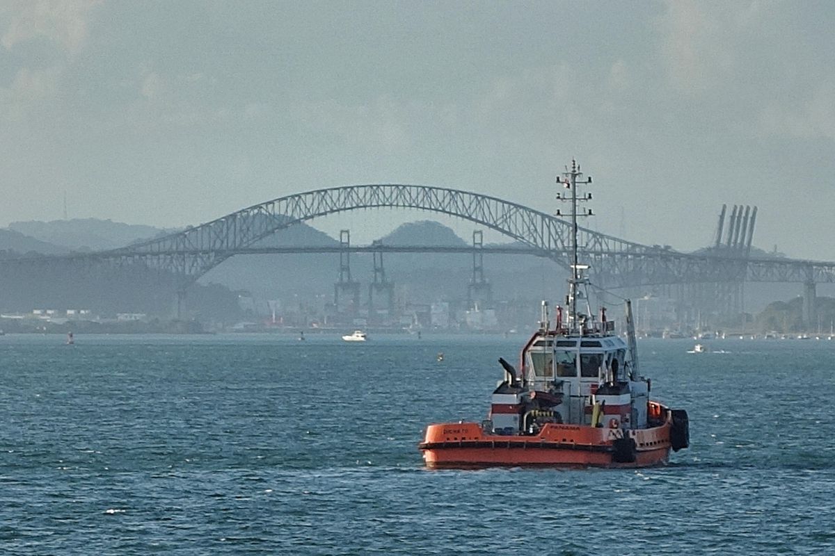
The skyline of Panama City was glistening in the afternoon sun as we anchored at our appointed spot to wait for our inspectors. But after the sun went down, it was the Bridge of the Americas that stood out, arching high over the Pacific entrance to the canal. Below, docks on both sides of the canal were busy loading and unloading thousands of CONEX containers.
One of the naturalists on board, Patrick Roca, was born in Panama. He’s been a guide for more than 20 years. “I picked up my American slang in the U.S. Army,” he said.
The connections between the U.S. and Panama run deep. But the thin strip of land that separates the Caribbean from the Pacific has been an active trade route for centuries.
“After the Spanish arrived, they started taking silver and gold from Peru and Bolivia,” said Roca. “For more than 100 years, there were mule trains that made the trek over Panama to ships waiting on the Caribbean side.”
The first railroad across the Isthmus was completed in the 1840s. Then, after the French abandoned their effort to build a canal, the U.S. military built the canal. The first ship sailed through in 1914.
Roca is quick to point out that the original canal itself is just one way to move goods from the Pacific to the Caribbean (or vice versa). After all, it’s expensive for ships to transit the canal. The rates are based on the maximum gross tonnage for cargo ships. There are fuel pipelines to take oil from coast to coast and load it up on tankers on the other side. In fact, lots of Alaska oil passed through those pipelines in the 1980s. There is a modern railroad with spurs that run right up to the dock to load containers for the quick journey across the country. There also is a fleet of tractor-trailer rigs to haul a few containers at a time. For the past two years, the new, expanded locks that run parallel to the original canal are equipped to accept new “neopanamax” ships up to 1,450 feet long. The largest ships can haul more than 13,000 containers at a time.
Even if you’ve read about the canal and its history, the scale of the project is bigger than any other project I’ve seen, even our very own trans-Alaska pipeline.
For example, I thought our ship, at 174 feet, was pretty big. Well, we had to “share” our lock time with another freighter who sailed in front of us. The original locks are designed for ships up to 960 feet. The “MTM Gibralter” is a chemical tanker flying a Singapore flag. At 462 feet, it was headed up to Texas. With both of our ships in the lock, there still was plenty of room.
Before our ship approached the first set of locks, we had more visitors: 14 Panamanian line workers. These workers boarded the ship from a pilot boat alongside our ship and took up stations at the front and rear of the ship (fore and aft) to hook up the one-inch steel cables to electric railroad engines that ran on tracks on both sides of the locks.
Ships sail under their own power through the locks. The cables and the rails are there to make sure the ship stays in the middle. The larger “Panamax” freighters can be 96 feet wide. That gives about 12 inches of leeway on either side of the lock.
Roca said when he has visitors in Panama, he likes to rent a 31-foot Boston Whaler, with a local captain. Then, he and his friends pile on board with a cooler for the eight-hour transit. “Yes, we still have to get a pilot on board,” he said. “But the experience is one they’ll never forget,” he said. The bill comes to a little over $2,000.
Ours was a night crossing. As we transited from the Pacific to the Caribbean, another car-carrying ship was going the other way. The original canal locks operate 24 hours a day, seven days a week. The new, larger locks only accept ships during daylight hours, although that is expected to change soon.
The U.S. and Panama still are bound by treaty when it comes to protecting the canal. Roca said that once each year, the U.S. ships thousands of troops and a variety of ships to participate in readiness drills. “It usually takes eight hours to transit the canal,” he said. But one Navy ship, a Pegasus class hydrofoil, made it in four hours,” he said.
Because of the long U.S. presence in the Canal Zone, the dollar still is legal tender in Panama. It’s a Spanish-speaking country, but English is widely spoken. The Panama Canal now is a defining economic engine for the country, in addition to its position in international banking, financing and logistics.
It was a jaw-dropping spectacle to move among the giant ships and be lifted up more than 80 feet from the Pacific Ocean to Lake Gatun. This reservoir, when constructed more than 100 years ago, was the largest-ever man-made lake (it has since been eclipsed by Lake Mead in Nevada).
But the next time I visit Panama, I’m going to bring my friends and look up Patrick for a ride in that Boston Whaler. That sounds like a riot. And I’ll bring the cooler.

