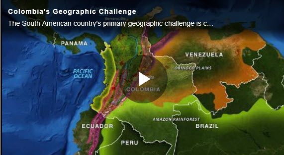
Stratfor Worldview put out this interesting article on Colombia. I find this country fascinating and ripe for expansion and future investment.
Colombia is located at the strategic meeting point of Central and South America. The country shares a land border with Panama, Venezuela, Brazil, Peru and Ecuador, and has coasts on both the Pacific Ocean and Caribbean Sea.
Colombia’s modern borders began to take shape in 1831 with the division of Simon Bolivar’s Gran Colombia. In 1903, the country lost another strategic territory when Panama gained its independence. Ever since, Colombia has had to maintain friendly relations with whoever controls the Panama Canal.
Colombia is dissected by three Andean mountain ranges: the Western, Central, and Eastern Cordilleras. Because of the country’s tropical equatorial climate, major population centers are concentrated in temperate zones at higher altitudes.
The country’s economic and political heartland is the capital city of Bogota. This core region has a population of roughly 8 million people. The Magdalena River Basin connects the core to Cartagena and Barranquilla, the country’s largest ports.
The dense Amazonian rain forests to the south, the sparsely populated Orinoco plains to the east, and the Pacific coastline make up Colombia’s periphery. These regions are home to valuable commodities such as oil and coal, as well as areas of drug trafficking and rebel insurgency. Consolidating control over these areas is currently Colombia’s primary geographic challenge.
Looking forward, the country’s natural resource wealth and close proximity to the United States could lead to ongoing economic opportunities. That said, the country will continue to be constrained by security challenges and by poor integration between Colombia’s population centers, the resource-rich hinterlands and the coasts.
